Earthquakes of the Historical and Instrumental Period in Türkiye and Its Surroundings (2100 B.C.-2009 A.D.)


GIS Maps Converted to Image File (Raster)
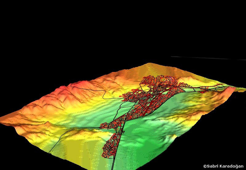
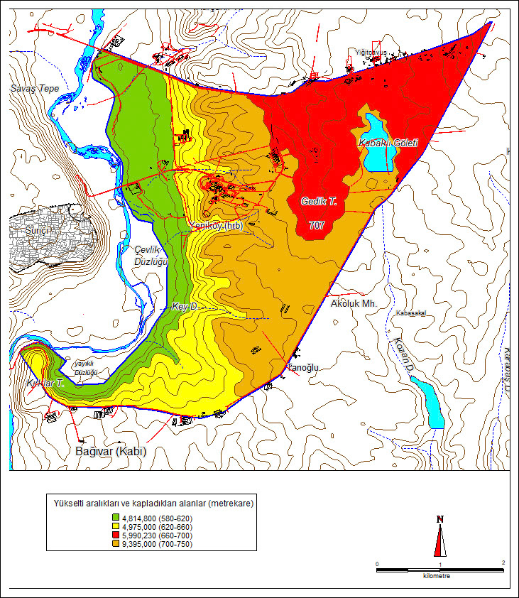
Colored topography map of Dicle University campus and its surroundings.
Colored topography map of Dicle University campus and its surroundings.
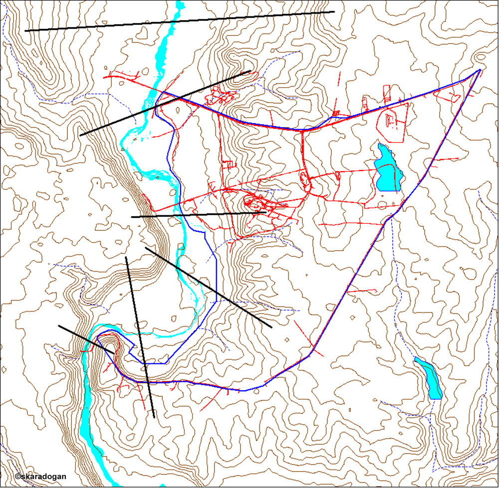
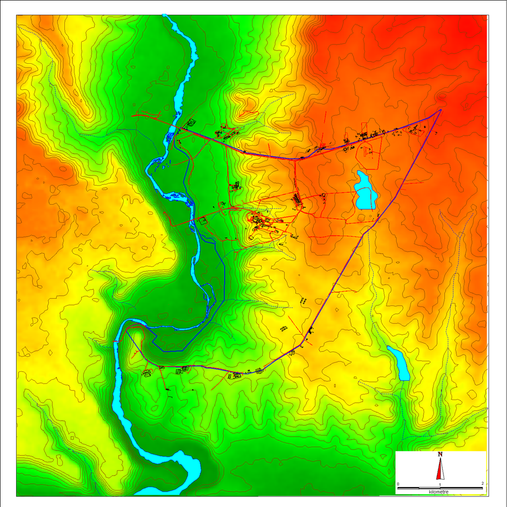
Topography map of Dicle University campus and its surroundings.
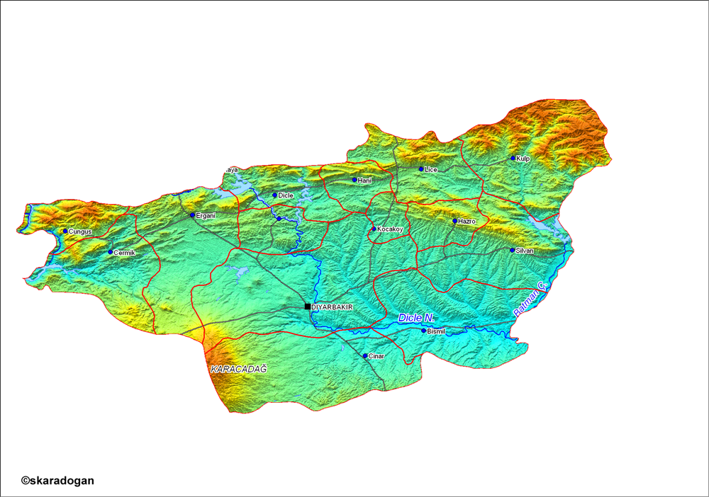
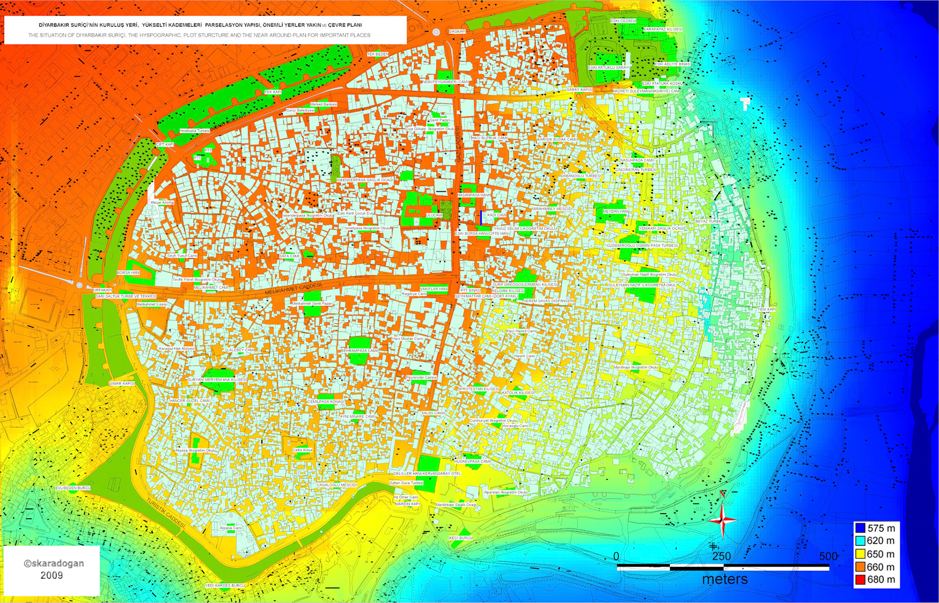
Diyarbakır province district borders and phyical map.
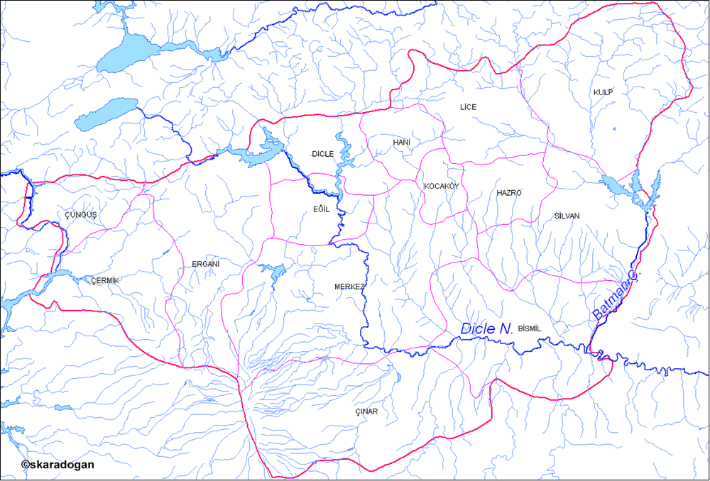
Diyarbakır province district borders and hydrography map.
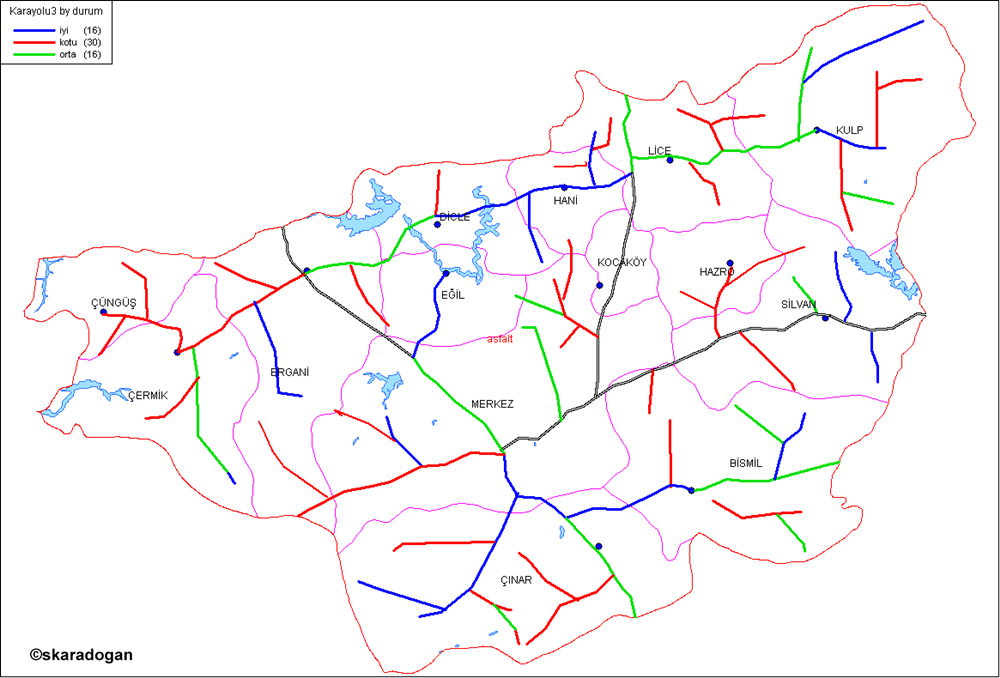
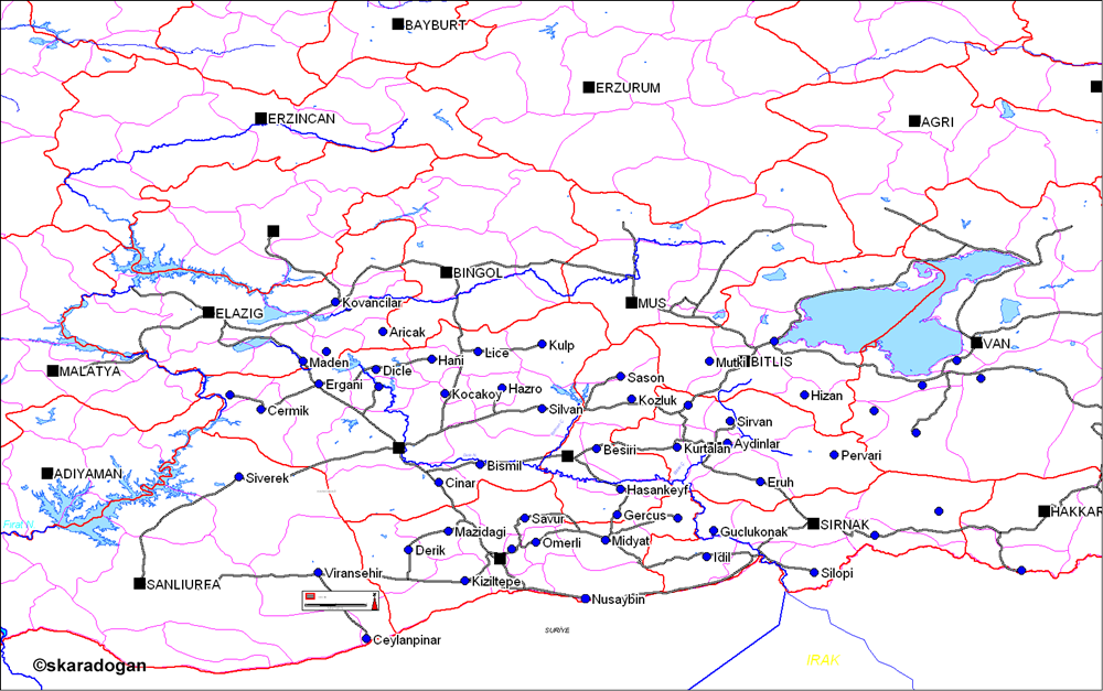
Diyarbakır provinces highway quality map.
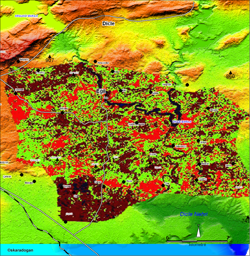
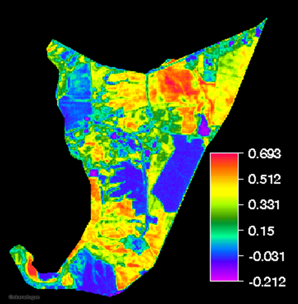
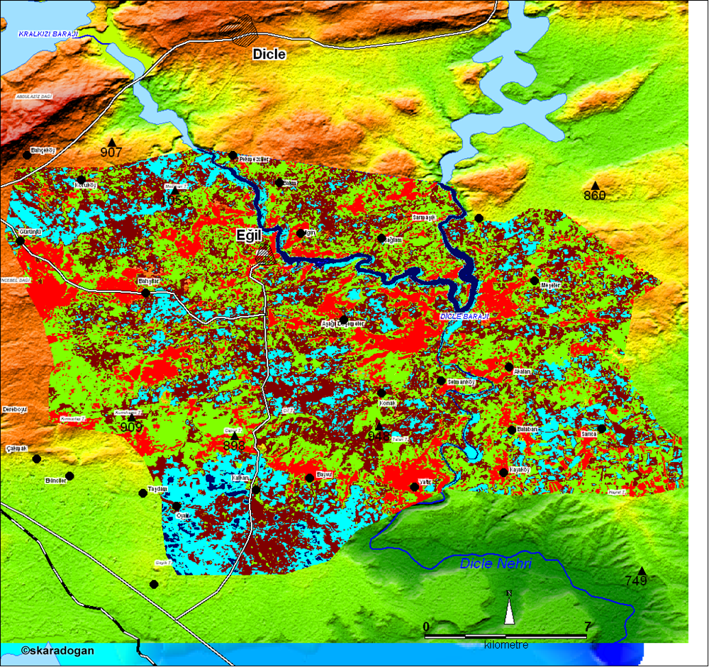
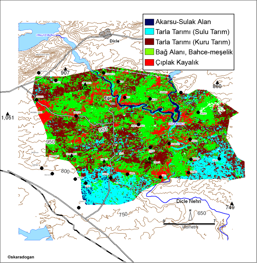
Eğil district land use map.
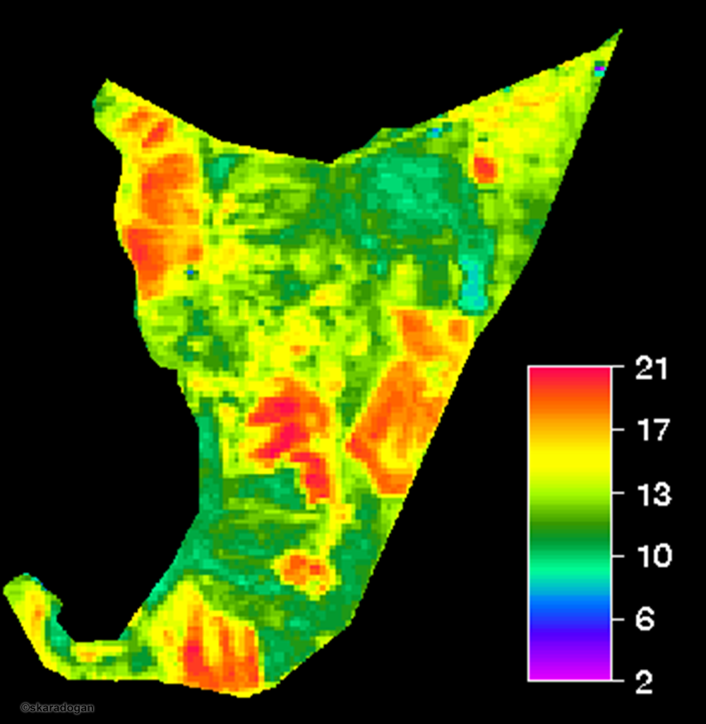
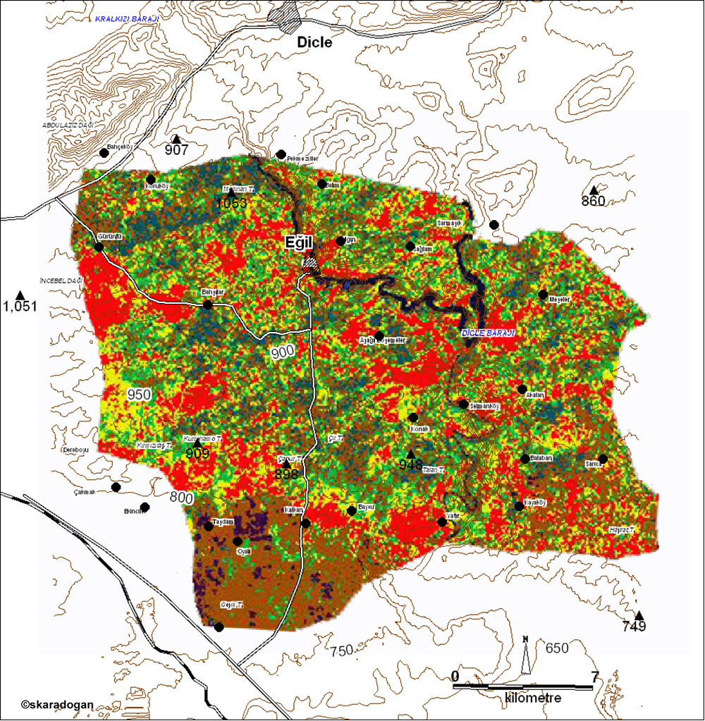
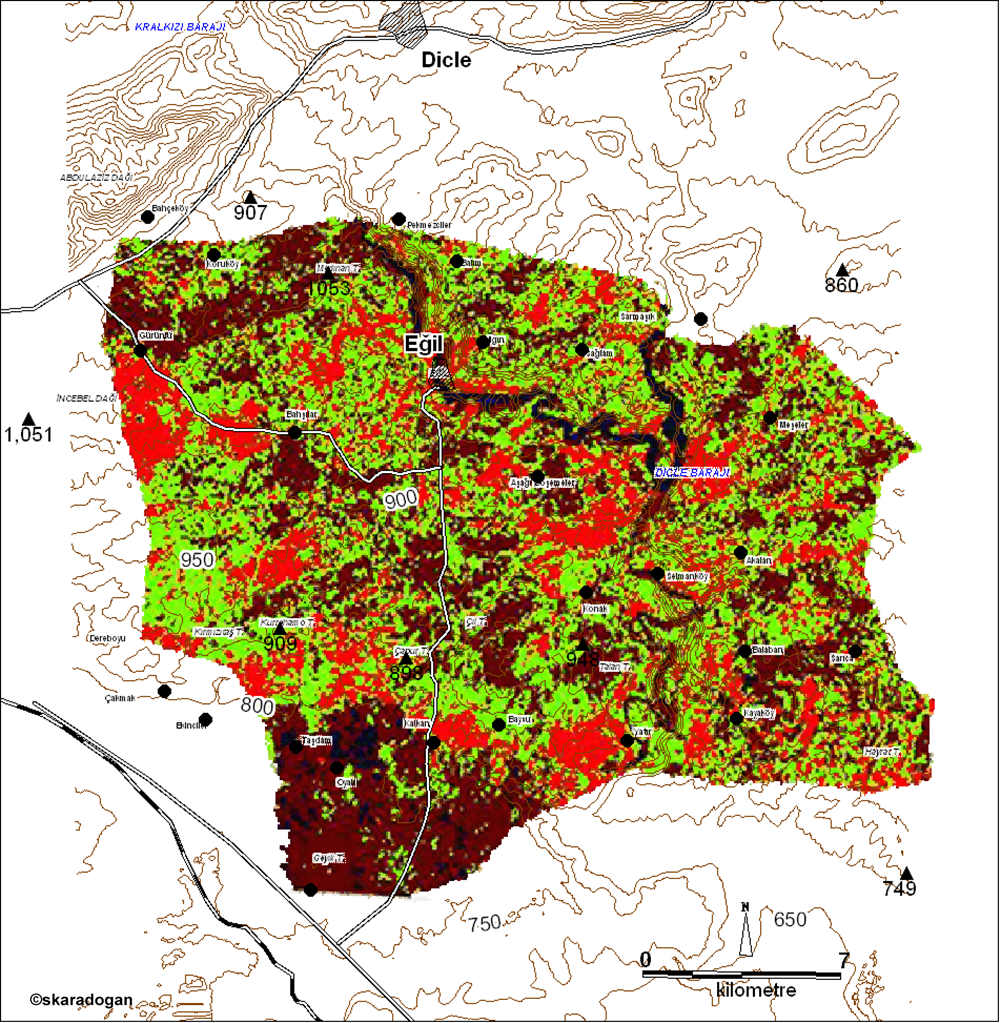
Eğil district topography map.
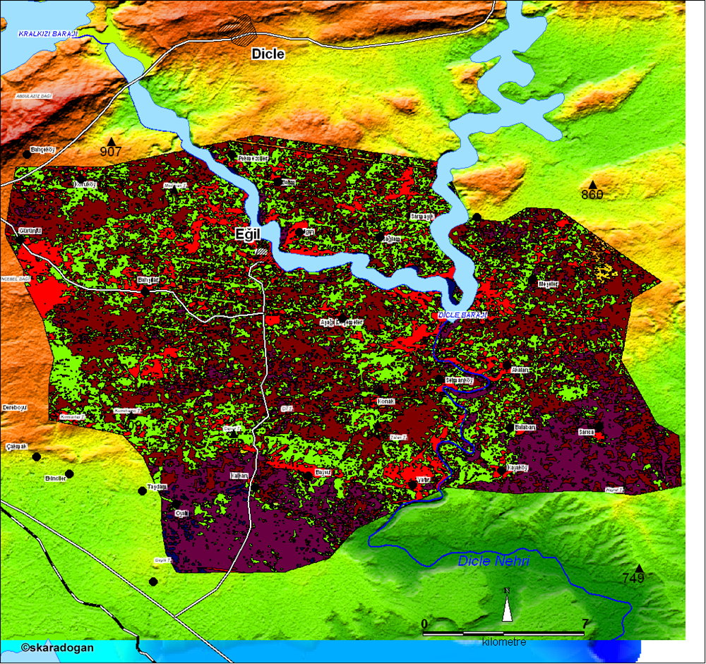
Eğil district land use map.
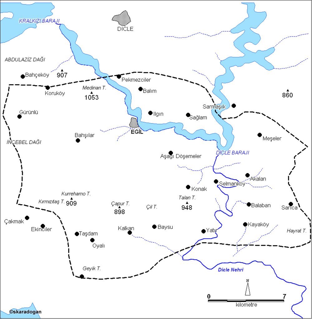
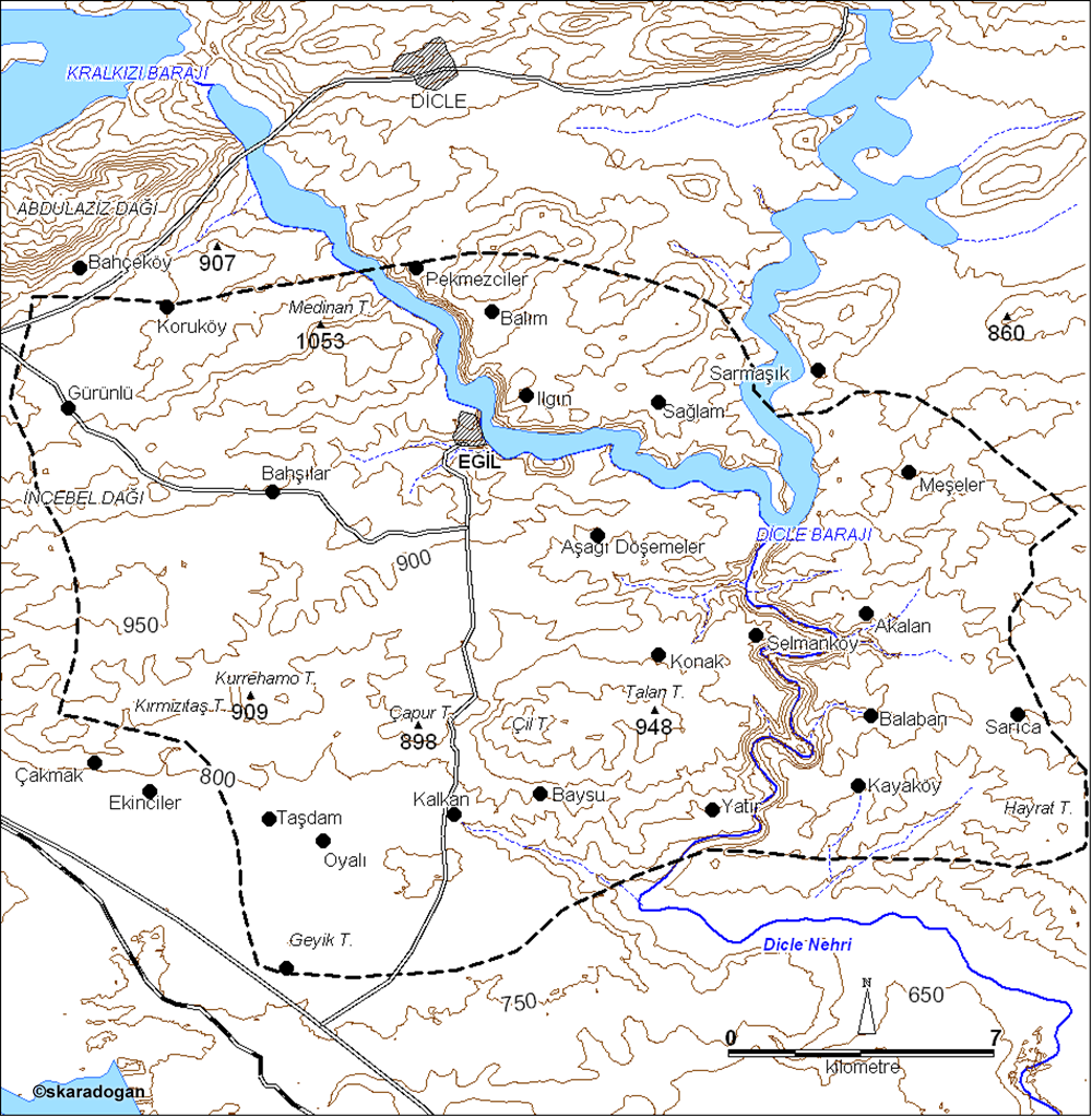
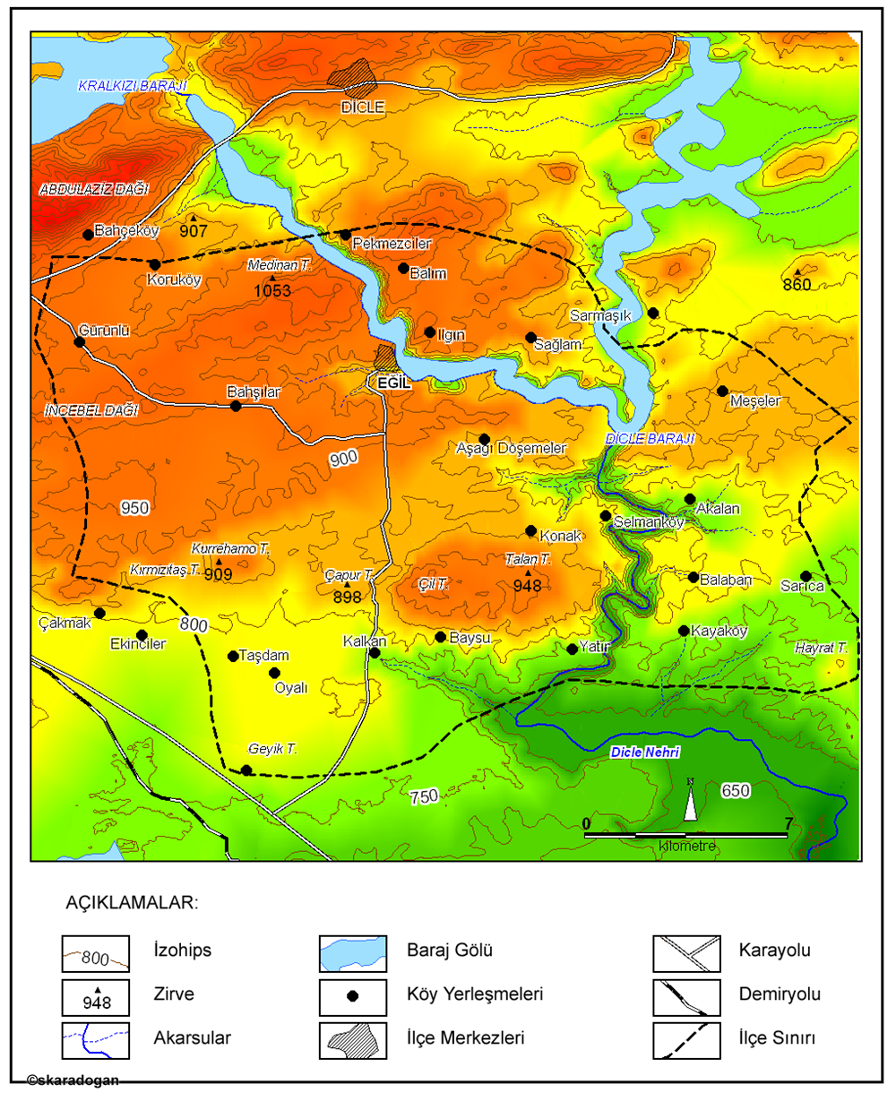
Eğil district borders and villages map.
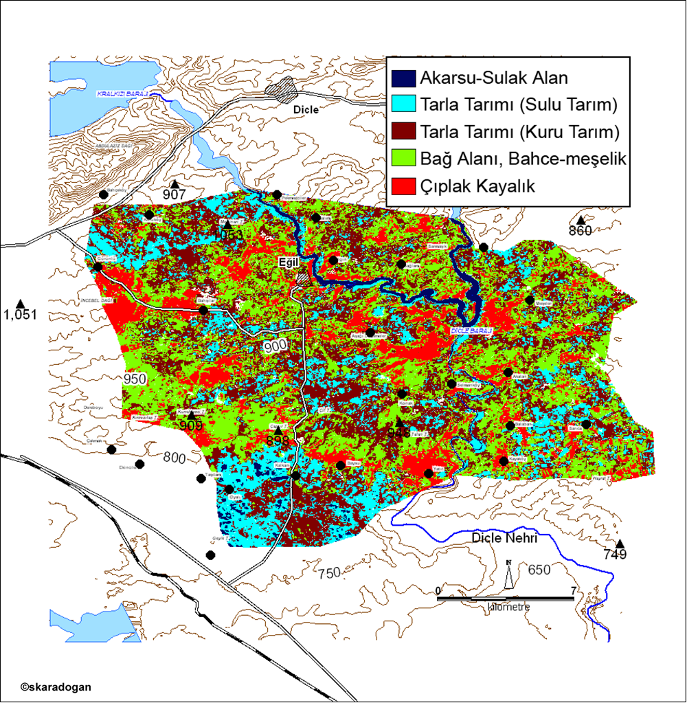
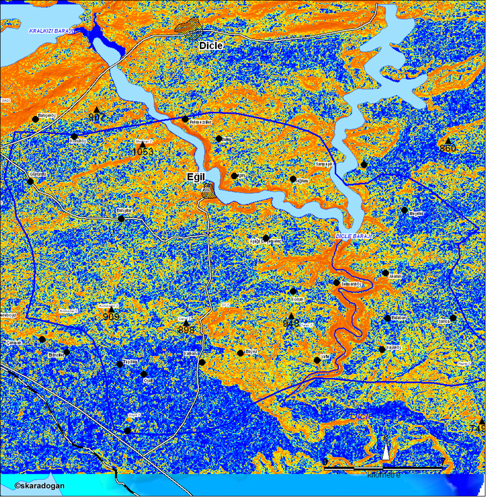
Eğil district land use map.
Eğil district land use map.
Eğil district land use map.
Eğil district land use map.
Eğil district land use map.
Eğil district land use map.
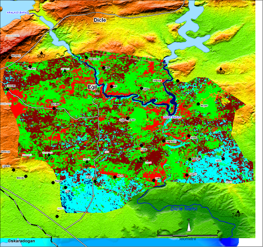
Aspect map of Eğil district.
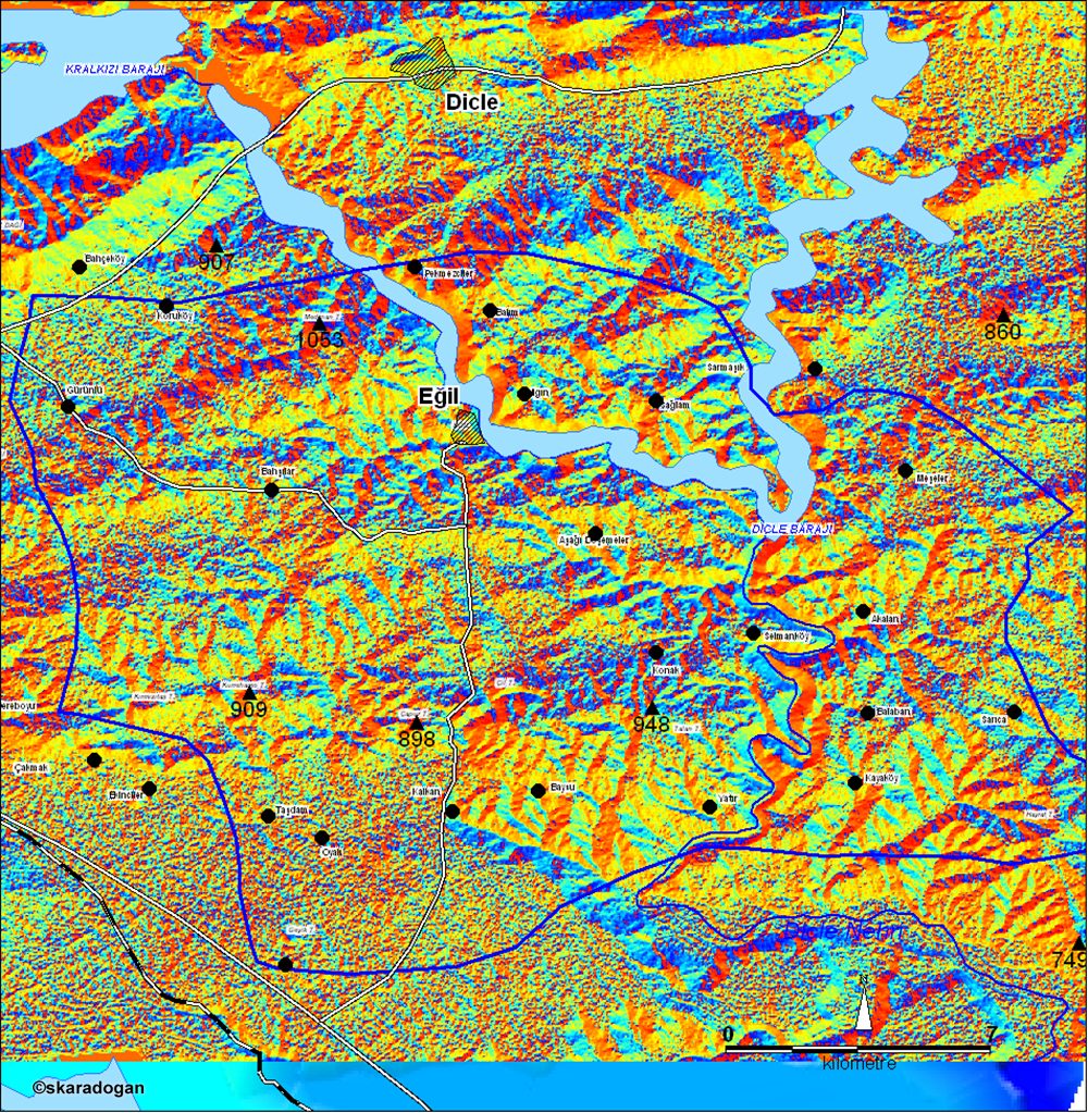
Eğil district slope map.
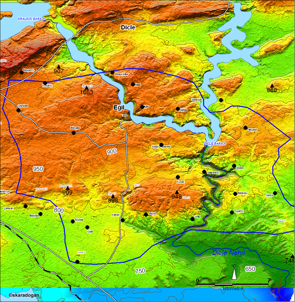
Eğil district topography map.
Eğil district topography map.
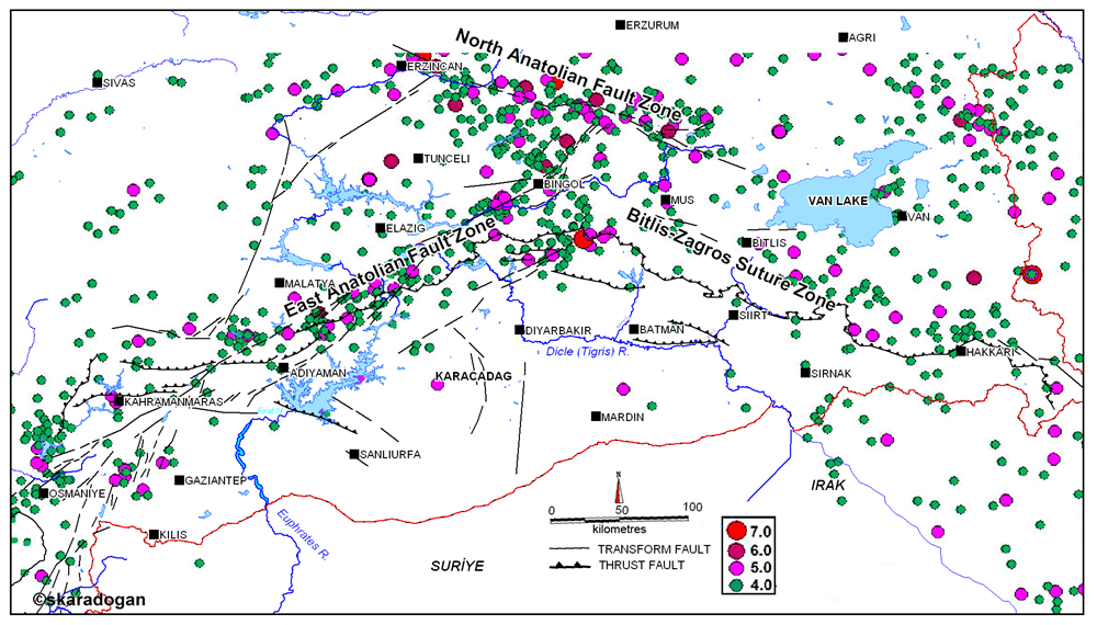
Southeastern Anatolia region and its surroundings instrumental period magnitude greater than four earthquake map.
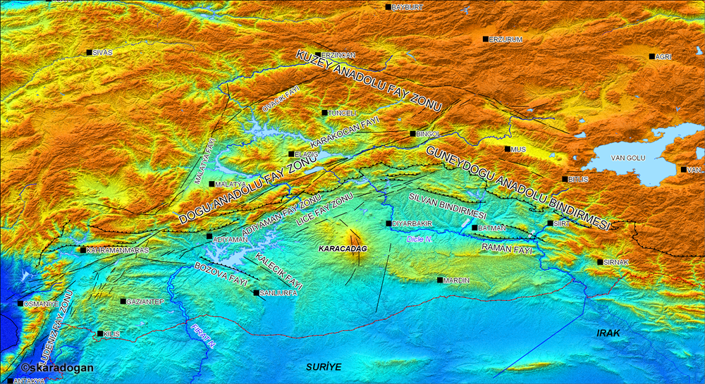
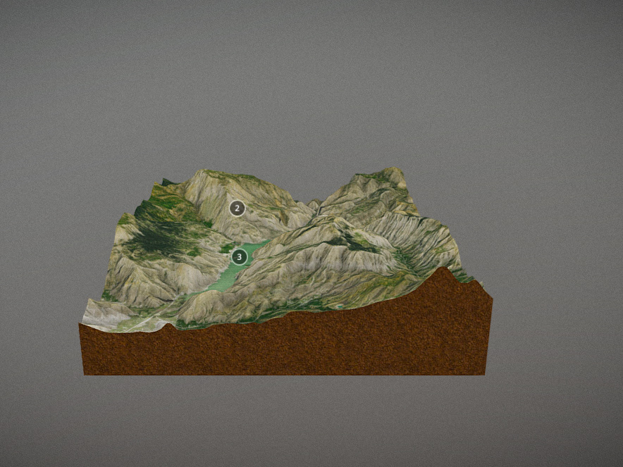
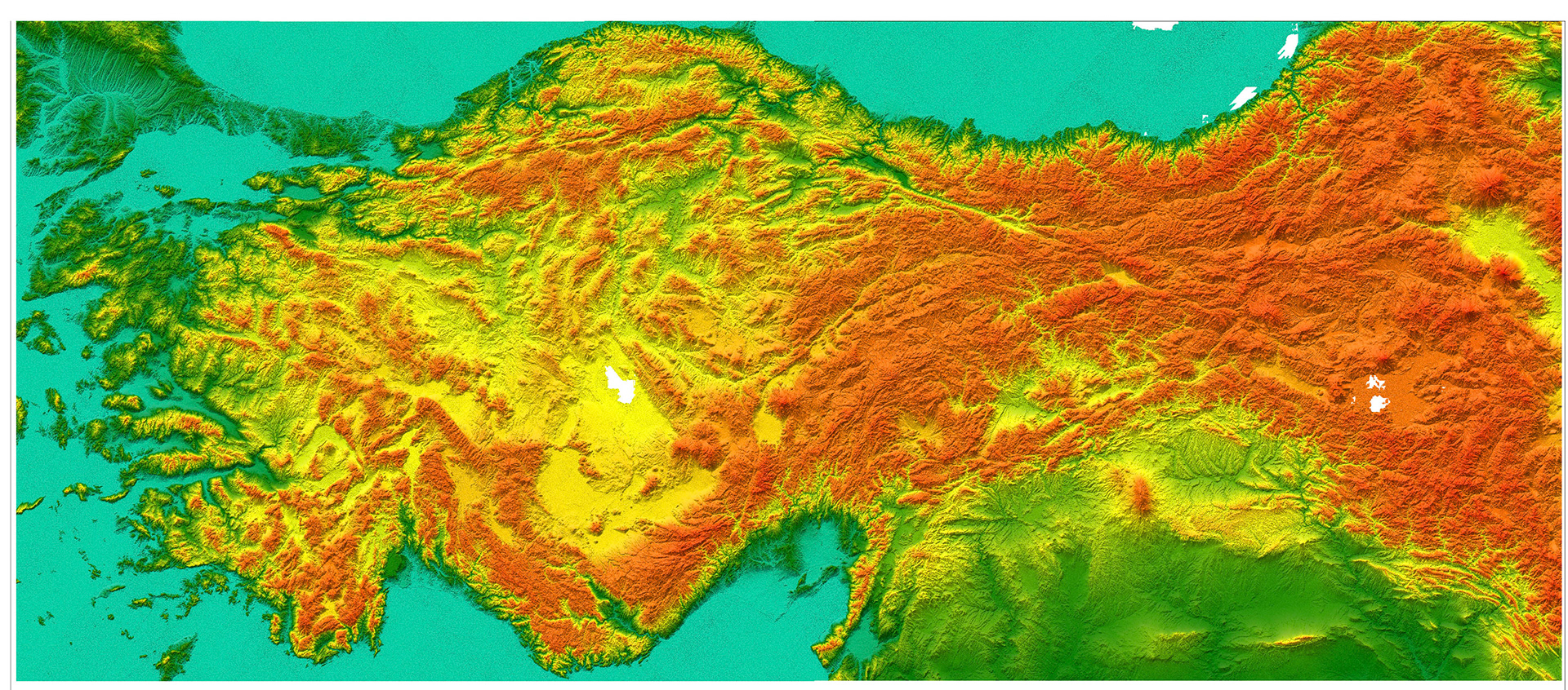
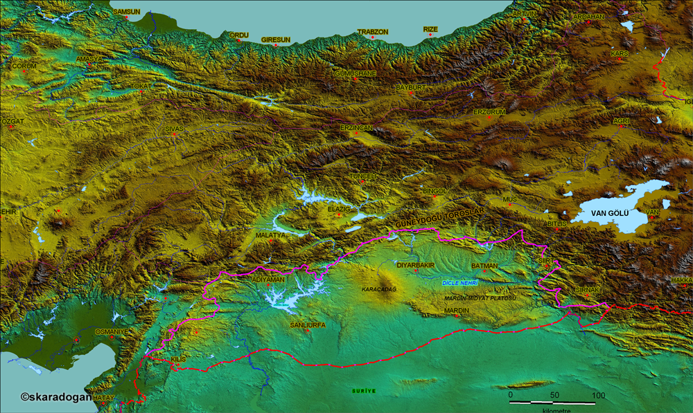
Southeastern Anatolia region physical and tectonic map.
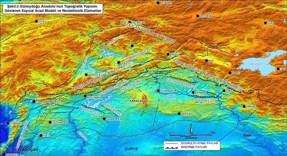
Southeastern Anatolia region physical and tectonic map.
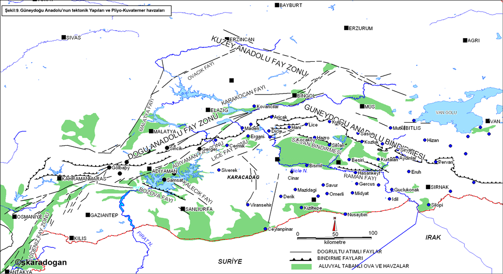
Southeastern Anatolia region and its surroundings tectonic structures and plio-quaternary basins map.
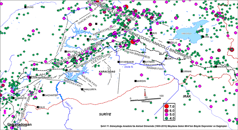
Southeastern Anatolia region and its surroundings instrumental period magnitude greater than four earthquake map.
Southeastern Anatolia region tectonic lines and buffer map.
Gap project dams.
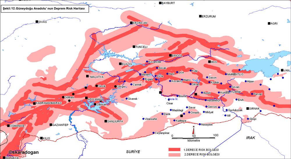
Anatolia region and its surroundings according to the natural rupture method on a district basis.
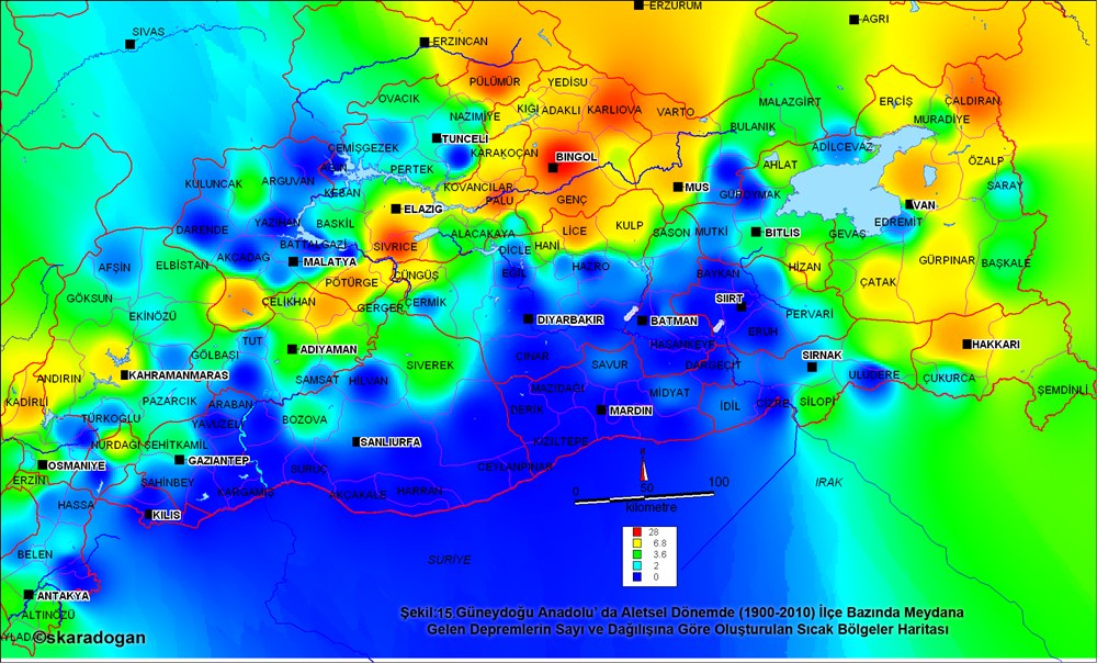
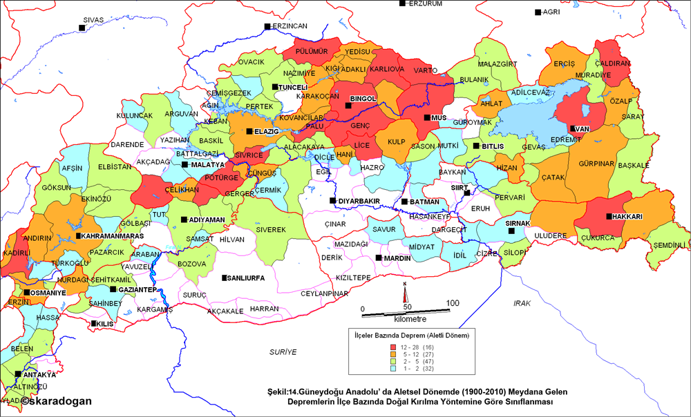
Hot zones map created according to the number and distribution of earthquakes that occurred in the instrumental period in the Southeastern Anatolia region and its surroundings.

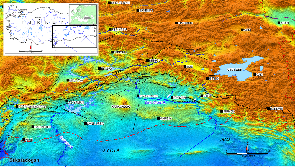
Southeast Anatolia region, physical map and tectonic structures