Digital terrain model of Ergani north.

Digital terrain model of Ergani north and Ergani district borders

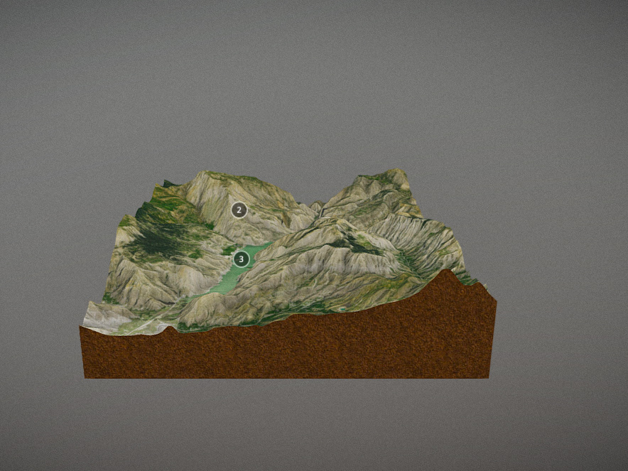
Digital terrain model of Ergani north and hydrographic geometry of the surroundings.

Geomorphology map of Ergani surroundings.

Geological section of Ergani surroundings

Ergani surroundings development and change of river drainage.

Geomorphology map of Dicle valley in east of Diyarbakır.

Vegetation profile of Diyarbakır basin and Hazro surroundings.

Population size temperature map of settlements in Hazro district.

Land use map of Hazro district.

Land use map of Hazro surroundings created by Corin method.

Distribution of prehistoric settlements in Southeastern Anatolia region.

Digital terrain model of Southeastern Anatolia region.

Water resources and water transmission distribution routes of Diyarbakır old city settlement.

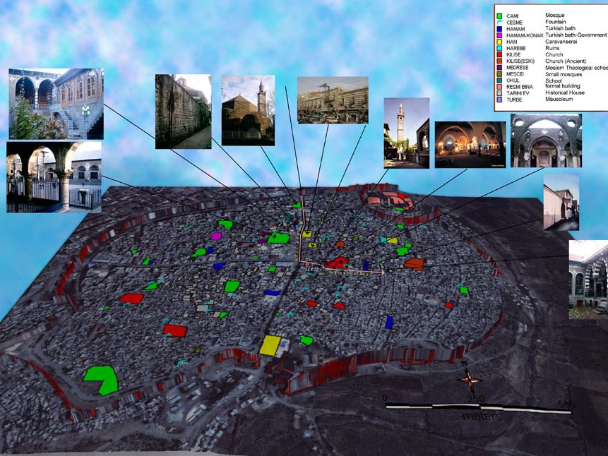
Diyarbakır, inside the city walls. Parceling structure and important places map.

Distribution of Neolithic Chalcolithic and Bronze Age settlements in the central Euphrates basin in the Southeastern Anatolia region.

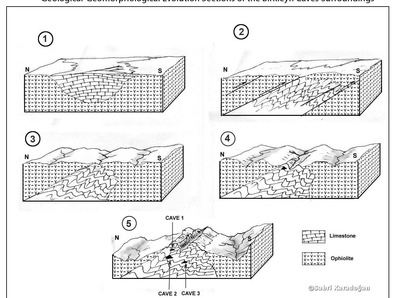
Profiles in the west-northwest and east-southeast directions obtained as a result of geological studies in the Tigris valley in the southeast of Diyarbakır. (with Mahmut Drahor)

Northern Mesopotamia and the Levant region. B.C. 10700 years. Earlier Epipaleolithic settlements.

Topographic map of the western half of the Tigris basin.

Topographic map of the Lower slope of the Garzan Basin.

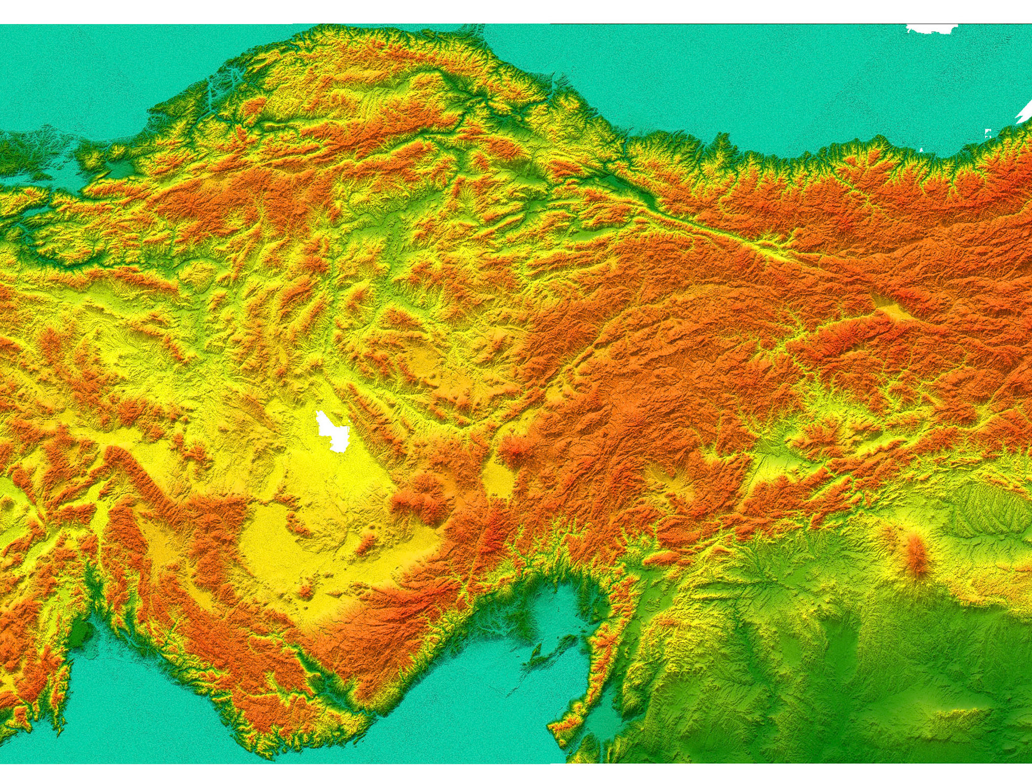
Digital terrain model and streams of Turkey and the Eastern Mediterranean basin.

Digital terrain model of Turkey and the Eastern Mediterranean basin.


3D digital terrain model and generalized geological section of the Southeastern Anatolia region

Water structures in Diyarbakır Suriçi.

Diyarbakır Suriçi's foundation site relief, parceling structure and important places map.


Topographic map of the Euphrates River vicinity in the vicinity of Bilecik


Profiles in the as a result of geological studies in the Tigris valley in the southeast of Diyarbakır. (with Mahmut Drahor)


(Hurşit Yetmen)


Profiles in the as a result of geological studies in the Tigris valley in the southeast of Diyarbakır. (with Mahmut Drahor)


Profiles in the as a result of geological studies in the Tigris valley in the southeast of Diyarbakır. (with Mahmut Drahor)


(Catherine Kuzucuoğlu)


Profiles in the as a result of geological studies in the Tigris valley in the southeast of Diyarbakır. (with Mahmut Drahor)


It was drawn using Aksoy et al., (2007).

It was drawn using Aksoy et al., (2007).

It was drawn using Aksoy et al., (2007).


Catherine Kuzucuoğlu


Profiles in the as a result of geological studies in the Tigris valley in the southeast of Diyarbakır. (with Mahmut Drahor)


Profiles in the as a result of geological studies in the Tigris valley in the southeast of Diyarbakır. (with Mahmut Drahor)

Profiles in the as a result of geological studies in the Tigris valley in the southeast of Diyarbakır. (with Mahmut Drahor)


Profiles in the as a result of geological studies in the Tigris valley in the southeast of Diyarbakır. (with Mahmut Drahor)

Profiles in the as a result of geological studies in the Tigris valley in the southeast of Diyarbakır. (with Mahmut Drahor)

Profiles in the as a result of geological studies in the Tigris valley in the southeast of Diyarbakır. (with Mahmut Drahor)

Profiles in the as a result of geological studies in the Tigris valley in the southeast of Diyarbakır. (with Mahmut Drahor)

Profiles in the as a result of geological studies in the Tigris valley in the southeast of Diyarbakır. (with Mahmut Drahor)